")
")


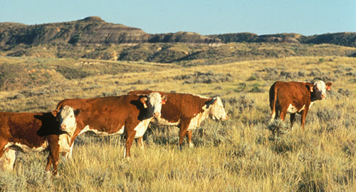 Predicting grassland productivity is a major challenge for ranchers and other land managers with grazing livestock. This productivity is key each spring when they are trying to decide how many cattle to turn out to pasture, how long to graze an area, or where forage might be abundant.
An online tool designed to help make such decisions is once again available this spring—with some new upgrades to ensure that it serves a wider audience and provides more helpful and detailed information.
The Grassland Productivity Forecast or "Grass-Cast" was developed in 2018 by scientists at the USDA Agricultural Research Service (ARS), along with other Federal agencies and several universities. It was originally designed for ranchers and grassland managers in the Northern Plains and was expanded in 2019 to cover the Southern Plains. Later this spring it will be expanded again to cover much of New Mexico and Arizona. Grass-Cast also will now be providing forecasts for individual 6-mile x 6-mile areas, rather than the county-by-county results available in previous years.
"It's increasingly popular with ranchers and other land managers, who are hearing about it from our partners with the Natural Resources Conservation Service (NRCS), Forest Service, Farm Service Agency, and University Extension. Still, we are always looking for ways to make it more useful, so we welcome any suggestions," says ARS economist Dannele Peck, who oversees Grass-Cast as director of the USDA Northern Plains Climate Hub.
During the 2019 season, the Grass-Cast website was visited nearly 3,000 times by over 1,800 different users.
Grass-Cast uses over 30 years of historical data about weather and vegetation growth—combined with seasonal precipitation forecasts—to indicate whether grasslands are likely to produce above-normal, near-normal, or below-normal amounts of vegetation. It is the result of a partnership between ARS, NRCS, Colorado State University, University of Arizona, and the National Drought Mitigation Center (NDMC) at the University of Nebraska-Lincoln.
The first Grass-Cast maps for the 2020 season were released in mid-April and will be updated every two weeks until the end of August to incorporate newly observed weather data. Grass-Cast becomes more accurate as the growing season progress so it should be consulted more than once. Land managers typically start paying close attention to the forecasts in May and June, when the risk of drought might prompt them to sell yearlings or older cows, wean calves early, buy feed, or move livestock to areas where grass is more plentiful.
Grass-Cast has some limitations, though. It cannot tell the difference between desirable and undesirable forage species, so land managers need to know what proportion of their pastures are weedy, and how those weeds will respond to rain, or a lack of it. They should also combine the forecasts with their knowledge of local soils, plant communities, topography, management history, and other conditions that affect vulnerability to drought, Peck says.
The Grass-Cast website provides tutorial videos, printable handouts, scientific papers, and other features. It can be accessed here.
The Agricultural Research Service is the U.S. Department of Agriculture's chief scientific in-house research agency. Daily, ARS focuses on solutions to agricultural problems affecting America. Each dollar invested in agricultural research results in $20 of economic impact.